
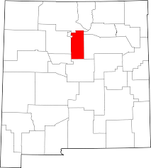
Santa Fe County, New Mexico has been working for nearly forty years to integrate water and land use planning by applying a development suitability lens to reduce natural resource degradation.
 The County’s efforts began in 1980 with the Santa Fe County General Plan. The growth management approach was to locate new growth in locations with adequate services and infrastructure while trying to limit growth in areas constrained by limited or low-quality water and natural hazards. In areas dependent upon groundwater, the County was divided into four hydrologic zones where a minimum lot size (base zoning) was set to reduce groundwater depletion. Within these zones, a 100-year water supply was required with demand calculated based on an estimate of 1-acre foot per lot, the same as permitted by the State. The minimum lot sizes for the four zones included: 160 acres, 80 acres, 40 acres and 10 acres. The development code was updated to include a requirement for new developments to conduct an analysis of land suitability, available infrastructure, and water resources. Developers could increase density if they completed a geo-hydrological study or entered into an agreement to use less than the allowed one-acre foot of water articulated in a conservation plan.
1999 update to the comprehensive plan continued to link new development to locations with suitable water, services, and infrastructure. In 2001, the County’s Sustainable Development Growth Plan changed direction. After thirty years of trying to protect natural resources by linking lot size and hydrological zones, the County adopted new zoning districts and development standards intended to better protect sensitive land, preserve open space and ensure high-quality infrastructure and services. The new approach identified three growth tiers:
- A priority growth area to accommodate new compact development served by surface water or community system and adequate public facilities and services.
- A future development area for infill development likely to occur within the limits of groundwater availability.
- And low-density agricultural land, environmentally sensitive land, and conservation areas.
The code includes a Water Supply, Wastewater, and Water Conservation requirement (Chapter 7 Section 7.13.) that defines how developers can satisfy the need for an adequate water supply. The location and scale of the development, the lot size, and proximity to water infrastructure determine whether a development uses a community water system or well. If applicants are connecting to the County utility, the only requirement is a written agreement to provide services. However, if the applicant is not on the County utility, then a more stringent set of requirements must be met. For a minor subdivision (over 5 lots) that is zoned to permit an individual or shared well, the County requires a valid Office of the State Engineer’s well permit and a hydrological study. Standards for the hydrological study include proof of an adequate water supply for 99-years and well test requirements for pump rates and recovery days linked to the different hydrological formations.
As part of development review, a Water Service Availability Report (WSAR) summarizes how a development meets the requirements for an adequate water supply. The WSAR includes an analysis of: existing system capacity of the public water or wastewater supply proposed for use; well field capacity or stream, spring, or other sources of raw water supply; historical average and peak use of potable water; the number of hook-ups and the estimated potable water demand per hook up; and the number of hook-ups for which contractual commitments have been made or previous development orders have been approved.
Developments must also meet water conservation requirements and file signed water restrictions and covenants with the plat or site development plan committing to not using more than 0.25 acre-foot per year per lot. Water conservation requirements include:
- Low water landscaping/xeriscapes.
- Drip irrigation and mulching.
- Kentucky bluegrass is prohibited, non-native grass is limited to 800 sq feet, and must be watered by water harvested or grey water.
- Water is permitted for new landscaping for up to two years, but thereafter only for viability.
- Between May and November, outdoor watering is prohibited between 11 am and 7 pm.
- Rain sensors.
- Fugitive water prohibition.
- Rainwater catchment for all new construction to capture a minimum of 85% of the roof area drainage.
- A domestic well metering program and submetering of landscape water use.
- WaterSense certified or equivalent plumbing toilets, urinals, lavatory faucets, and showerheads.
- EnergyStar certified or equivalent dishwaters, washing machines.
- Water and energy efficiency hot water systems.
- For food service, water available only upon request.
- For lodging services, daily linen services only upon request.
- Conservation signage and literature distribution.
Case Study Resources
Downloaded from ResilientWest.org
a project of
Resilient Communities and Watersheds